Overview
Vision
Over the next ten years, 33,000 homes will be provided, and once fully developed the area will be home to around 250,000 people.
Our Implementation plan provides a framework to ensure communities have access to jobs, schools, parks, community facilities, public transport and services to meet their needs and support growth in the area.
Our objectives
Create vibrant and liveable neighbourhoods
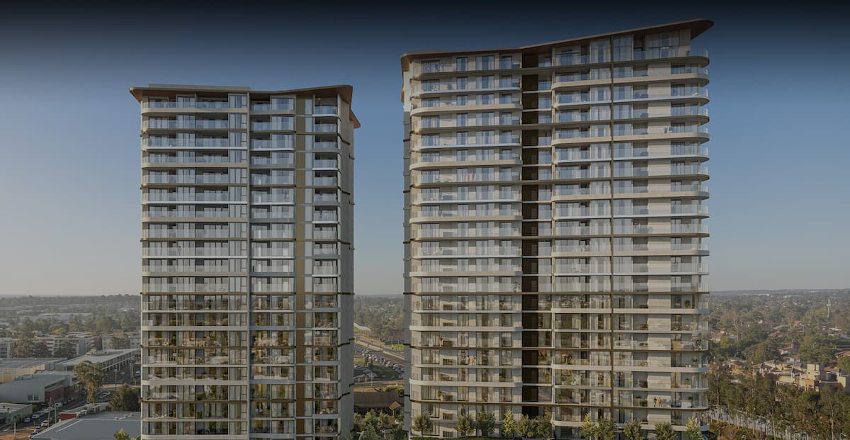
New homes will be close to shops, schools and transport. People will also have access to nearby community facilities such as parks and cafes. Terraces, townhouses and apartments will be located close to transport and areas of employment. We will continue to work on providing more affordable housing where possible.
Provide more homes and greater housing choice
We’re planning for a range of housing types at different price points, giving people more choice when it comes to owning their own home. Over 33,000 new homes will be built by 2026.
Coordinated housing and infrastructure delivery
Our Implementation plan identifies essential infrastructure needed to service current and future residents. New and upgraded roads will make it easier to get around and provide access to essential services such as shops and schools.
New planning controls will ensure that the right infrastructure is available in time to meet the needs of growing communities.
We will monitor development activity and demand, and work with infrastructure delivery partners to fast track infrastructure projects where necessary.
Provide local jobs
Communities will have access to local jobs, including those nearby at Marsden Park, Rouse Hill, Norwest Business Park, Blacktown and Penrith.
Improve recreation facilities
Our Implementation plan identifies more open space for growing communities. The Eastern Creek corridor will provide new open space and better green connections to homes. A green pedestrian and cycleway network will link growing suburbs to protected bushland and places for recreation.
Improve transport accessibility and connectivity
A transport network and major infrastructure projects such as the Sydney Metro Northwest will ensure growing communities have access to public transport options and connections to surrounding areas. The upgrade of Richmond Road and future bus connections will reduce the need for cars for local trips.
North West Priority Growth Area Video Overview
Over the next 30-40 years, up to 90,000 homes could be developed in the North West Priority Growth Area, 20,000 more than originally envisaged ten years ago. Our Plan will balance the needs of residents with the timely delivery of infrastructure, services and facilities.
Housing
It is anticipated that around 33,000 new homes will be delivered in the North West Priority Growth Area over the next ten years. When the area is fully developed, it will provide homes for up to 250,000 people.
Type of housing
Family homes still make up the majority of housing in the growth area, but there is growing demand for more diverse housing types like terraces, apartments and studios. House and land sizes are decreasing as the convenience and housing affordability becomes increasingly important. Our implementation plan is responding to these changes by ensuring that a range of housing types at different price points is available, giving people more choice when it comes to owning their own home.
The graph below shows that number of new homes that can be delivered in each of the precincts that makes up the North West Priority Growth Area.
Future Dwellings within the North West

Jobs
Currently, there is enough land zoned for employment and industrial purposes in the North West Priority Growth Area to support more than 43,000 jobs.
Our Land Use and Infrastructure Implementation Plan identifies opportunities for additional employment lands which will continue to support the development of key areas such as Marsden Park, which is expected to provide over 10,000 jobs.
The Implementation Plan also identifies a growth corridor between Marsden Park and Rouse Hill which will focus on supporting job growth and specific land uses within the corridor.
Transport Infrastructure Strategy

Current projects
| ITEM | |
| C1 | Sydney Metro Northwest – The project is expected to be completed by 2019.
Funding: $8.3 billion from the NSW Government. |
| C2 | Public transport corridor between Rouse Hill and Marsden Park – Reserve corridor for future public transportation between Cudgegong Road to Marsden Park Public. |
| C3 | Richmond Road upgrade – Stage 2 between Townson Road and Garfield Road West was completed in November 2016.
Funding: $96 million from the Housing Acceleration Fund. |
| C4 | Schofields Road upgrade – Stage 2 between Tallawong Road and Veron Road, is currently under construction. To be completed early 2017.
Funding: $70 million from the Housing Acceleration Fund. |
Infrastructure to be built by the year 2026
| ROADS | MEASURE |
| R1 | Hambledon Road upgrade (Schofields Road to Burdekin Road/Stanhope Parkway) |
| R2 | Boundary Road and part of Kensington Park Road (Schofields Road to McCulloch Street) |
| R3 | Quakers Road |
| R4 | Schofields Road Stage 3 (Richmond Road to Veron Road) |
| R5 | Richmond Road Stage 3 (Bells Creek to South Creek floodplain) |
| R6 | Hambledon Road North Extension – Oak Street – Clark Street Stage 1 (Schofields Road to Guntawong Road) |
| R7 | Railway Terrace (Riverstone Road to Schofields Road) |
| R8 | McCulloch Street upgrade (Kensington Park Road to 400m south of Garfield Road East) |
| R9 | Hambledon Road North Extension – Clark Street/Oak Street extension Stage 2 (Guntawong Road to Garfield Road) |
| R10 | Townson Road (Meadow Road to Burdekin Drive) |
| R11 | Terry Road upgrade (Windsor Road to Mason Road) |
| R12 | Bandon Road Extension (Chapman Road to Boundary Road via Commercial Road and Menin Road) |
| R13 | Bandon Road |
| R14 | Garfield Road |
| R15 | Hambledon Road North Extension – (Garfield Road to Windsor Road) |
| R16 | Withers Road (Mile End Road to Annangrove Road) |
| R17 | The Water Lane (Annangrove Road to Nelson Road) |
| R18 | Nelson Road (Windsor Road to The Water Lane) |
| R19 | New Shanes Park Road: Richmond Road to Glengarrie Road Glengarrie Road to Stoney Creek Road |
| R20 | South Street West (Richmond and Glengarrie Road) |
| R21 | Daniels Road Bus Only Link – Hollinsworth Road to Daniels Road (Rapid Bus Route) |
| R22 | Stony Creek Road (New Shanes Park Road to Palmyra Avenue) |
| R23 | Wallace Road (Deviation of Wallace Road to Riverstone Parade, including Hamilton Street) |
| R24 | Glengarrie Road (South Street to Garfield Road West) |
| R25 | Loftus Street (Windsor Road to Hamilton Street) |
| R26 | Veron Road (Townson Road to Schofields Road) |
| R27 | Quakers Hill Parkway (Quakers Road to Hambledon Road – 2 x intersections only) |
| R28 | Burdekin Road (Walker Street to Railway Terrace) |
| R29 | Burdekin Road Rail Overpass |
Infrastructure required beyond 2026
| T1 | Outer Sydney Orbital |
| T2 | Rail network |
Utility Infrastructure Strategy

| UTILITY SERVICES – TO BE ACCELERATED | |
| S1 | South Marsden Park Zone Substation (SMP ZS) |
| S2 | Riverstone East / Box Hill Zone Substation (RE/BH ZS) |
| S3 | North Box Hill Zone Substation (NBH ZS) |
| UTILITY SERVICES – REQUIRING ADDITIONAL CAPACITY | |
| S4 | Vineyard (West) Sewer Pump Station (SPS W) |
| S5 | Vineyard (North) Sewer Pump Station (SPS E) |
| S6 | Marsden Park North Sewer Pump Station (PAP C) |
| S7 | Existing Sewer Pump Station pumping to North Kellyville (SPS 1139) |
| S8 | Rouse Hill Waste Water Treatment Plant (RH WWTP) |
| S9 | Marsden Park Zone Substation (MP ZS) |
Coordination of infrastructure
Grants to councils
$184.9 million in funding under the Local Infrastructure Growth Scheme has been provided to councils to help keep housing affordable and to fund local infrastructure plans.
Infrastructure has been funded through the Housing Acceleration Fund, with $475 million provided to support over 160,000 homes and 1,200 hectares of employment land. In the North West Priority Growth Area this funding support has included:
- $54 million for trunk sewer and waste water lead-ins in Riverstone and North Kellyville Priority Precincts
- $70 million for Stages 2 and 3 of the Schofields Road upgrade
- $96 million for Stage 2 of Richmond Road upgrade.
We are working with infrastructure agencies and councils to identify projects that could be funded with the $400 million that was announced in 2015-16 State Budget.
Special Infrastructure Contribution (SIC)
A Special Infrastructure Contribution (SIC) will be used to help fund regional infrastructure, biodiversity and affordable housing.
We are reviewing the existing Western Sydney SIC to ensure that the items listed and the timing for these works reflect the current priorities and housing supply forecasts established by this Implementation Plan. We will consult on any changes to the Western Sydney SIC before changes are made.
To date, $76.628 million has been collected through SIC funding, which has helped to fund road upgrades and deliver infrastructure in the area. Over $18 million of this has been spent on protecting bushland within the Cumberland Plain.
Action Plans

Action 1: Exhibit rezoning proposals for the remaining North West Priority Growth Area precincts that have potential to deliver more homes and jobs
Action 2: Undertake a strategic land use review of the future public transport corridor between Rouse Hill and Marsden Park and the upgrade of Schofields Road
Action 3: Establish new density controls for residential land so that new communities are supported by adequate infrastructure and local councils can plan for the new population precinct plans into a single precinct plan
Action 4: Work with Infrastructure NSW, local councils and the NSW State Emergency Service to review planning controls for land within the Hawkesbury-Nepean Valley which includes land below the probable maximum flood (PMF) level public transport corridor between Rouse Hill and Marsden Park and the upgrade of Schofields Road
Action 5: Transfer planning controls into local environmental plans to make development controls more consistent
Action 6: Consolidate existing precinct plans into a single precinct plan
Action 7: Coordinate and monitor the delivery of a capital works program for infrastructure items supported by the Special Infrastructure Contribution (SIC) fund to support housing delivery
Action 8: Promote a Green Grid through the Eastern Creek regional open space corridor which will connect with the Western Sydney Parklands, the Wiannamatta Regional Park and Rouse Hill Regional Park
If you would like more information on the North West Priority Growth Area then visit the NSW Planning website.